
2022-08-06 - Barrett Gray, Charlie Levy - mix gender team, supported - 12h 9m 0s
2022-08-07 - Jonathan Hadlock - male unsupported - 13h 55m 8s
2020-09-12 - Mathias Eichler, Scott Michie, Chris Strode - male, self-supported - 16h 18m 21s
2022-08-19 - Brenda Gordon, Gina Dempsey - female self-supported - 17h 35m 33s
‘THAT FEELING OF ACCOMPLISHMENT’
09/19/2020
‘OVERNIGHT ON COPPER’, WITH TABATHA COLLINS AND MARY FLINDERS
08/06/2021
‘‘A FUN RIDGE LINKUP’, WITH BARRETT GRAY AND CHARLIE LEVY
08/31/2022
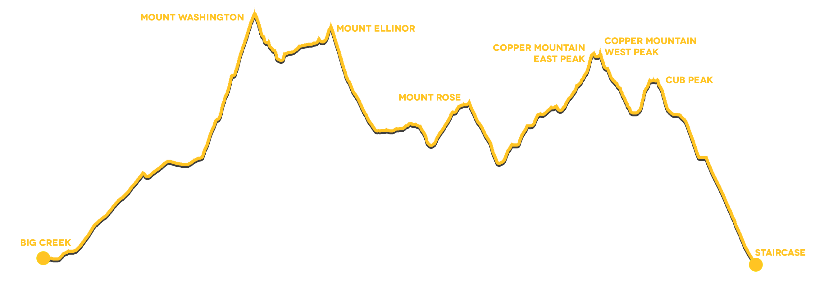
This is the closest stop to town. There are bathrooms, but no water and a bit of cell service. Why drive further? Start your run here. You'll need a National Park or Forest pass to park inside the campground but you can also park along the road just outside the gate.
3.3miles, 2,700ft of vertical gain.
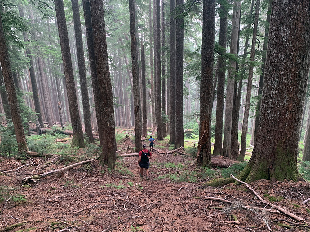
Your climbing adventure begins on the rolling, cushy trails towards the lower trail head of Mount Ellinor
1.7miles, 400ft of vertical gain.
Take the lower trailhead connector and follow the gentle climbing gravel road up to the Mount Washington trailhead. Stay straight up to the Mount Washington trailhead and do not take the left to the Upper Mount Ellinor trailhead.
2miles, 3,100ft of vertical gain.
Climb along the standard route:
The first section of this trail winds its way playfully along a rough path over tree roots and boulders until you reach the first scree field above a small overgrown valley.
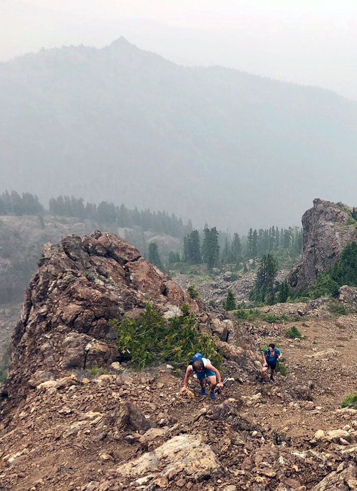
From there things get a bit more difficult to navigate and you have to feel your comfort level. Several routes lead to the saddle. Hang right to avoid the second scree field, climb a couple head wall sections and follow a few cairns to the top.
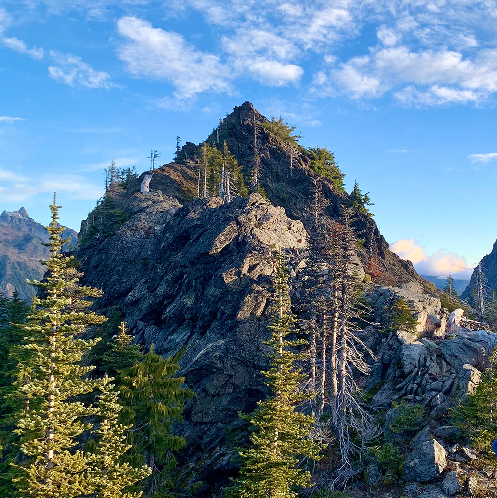
From the saddle the final section leads right to the summit via an obvious trail that takes you along a narrow and very exposed path underneath the summit. Climb straight to the top.
1.5miles, 700ft of vertical gain.
There's a very exposed ridge line traverse option which isn't advisable without climbing gear and rope. The preferred lower traverse drops almost 800ft from the summit and leads along a scree field below the saddle past 'dead man's plaque' (don't climb up that notch) to a steep gully heading into the general direction of Mount Ellinor. Dropping that far down seems a bit far, but you get to avoid most of the real exposed stuff. You still will deal with lots of nasty scree and loose footing along the way, but it feels more 'runnable'. Climb a narrow chute and cross another scree field until you reach an incredible valley filled with car sized boulders and steep sharp peaks all around you. Climb out of it on the opposite site you came in from and you find yourself on a little saddle with just one short scree field separating yourself and the small plateau the winter route avalanche gully pops out. From there take the small goat/boot path to the summit of Mount Ellinor.
3miles, 3,000ft of vertical loss.
After the tough traverse and the well-deserved summit take the main trail down just past the Upper Trailhead junction and connect with the Bear Camp connector trail. Here is where we stashed some much needed water. (There aren't many water sources on the route, be mindful of that!)
0.5miles, 300ft of vertical loss.
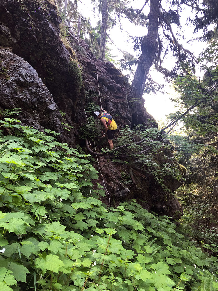
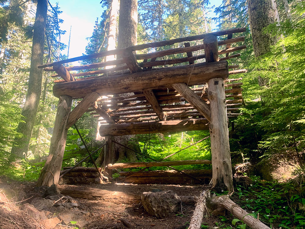
Enjoy crossing several little bridges hugging the hillside and marvel at the care the trail builders have put into the upkeep of this little-know trails. Oh, and watch your step, some of the roped sections are pretty exposed. Bear Camp is an impressive and annoying place. Check out the cool structure, but try avoiding all the bugs. The trail to Mount Rose begins opposite of the structure when standing in front of it. That next section can be a bit overgrown and you'll lose quite a bit of elevation here. Climb over some downfall to reach the Mount Rose summit loop trail.
1.3miles, 1000ft of vertical gain.
Now, back on a well-groomed trail climb the final 1,000ft to the Mount Rose summit. Stay counter-clockwise along the ridge line.
1mile, 500ft of vertical gain.
Just beyond the Bear Camp structure a narrow overgrown trail veers left toward Bear Gulch. It's a trail, but there are lots of blown down trees and it's minimally maintained. This trail ends at what the map calls Bear Gulch.
1mile, 1,200ft of vertical gain.
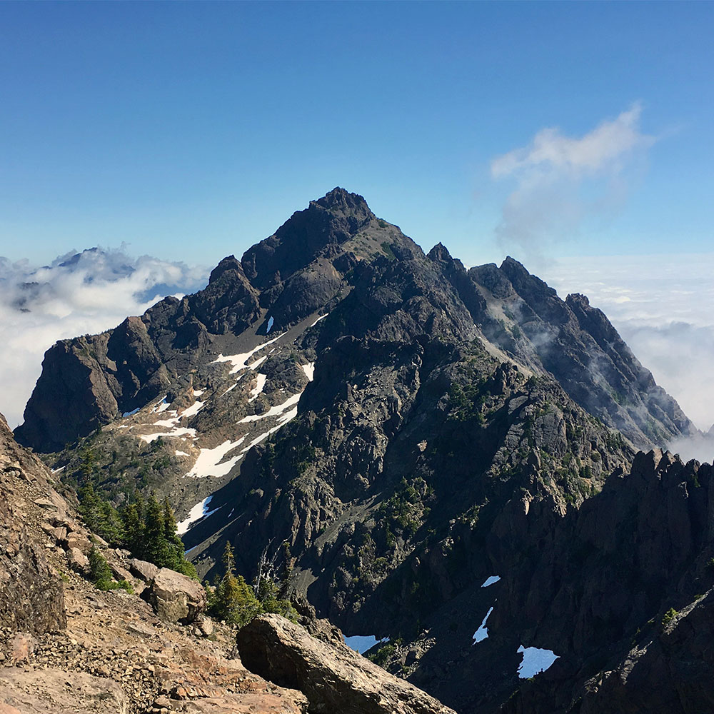
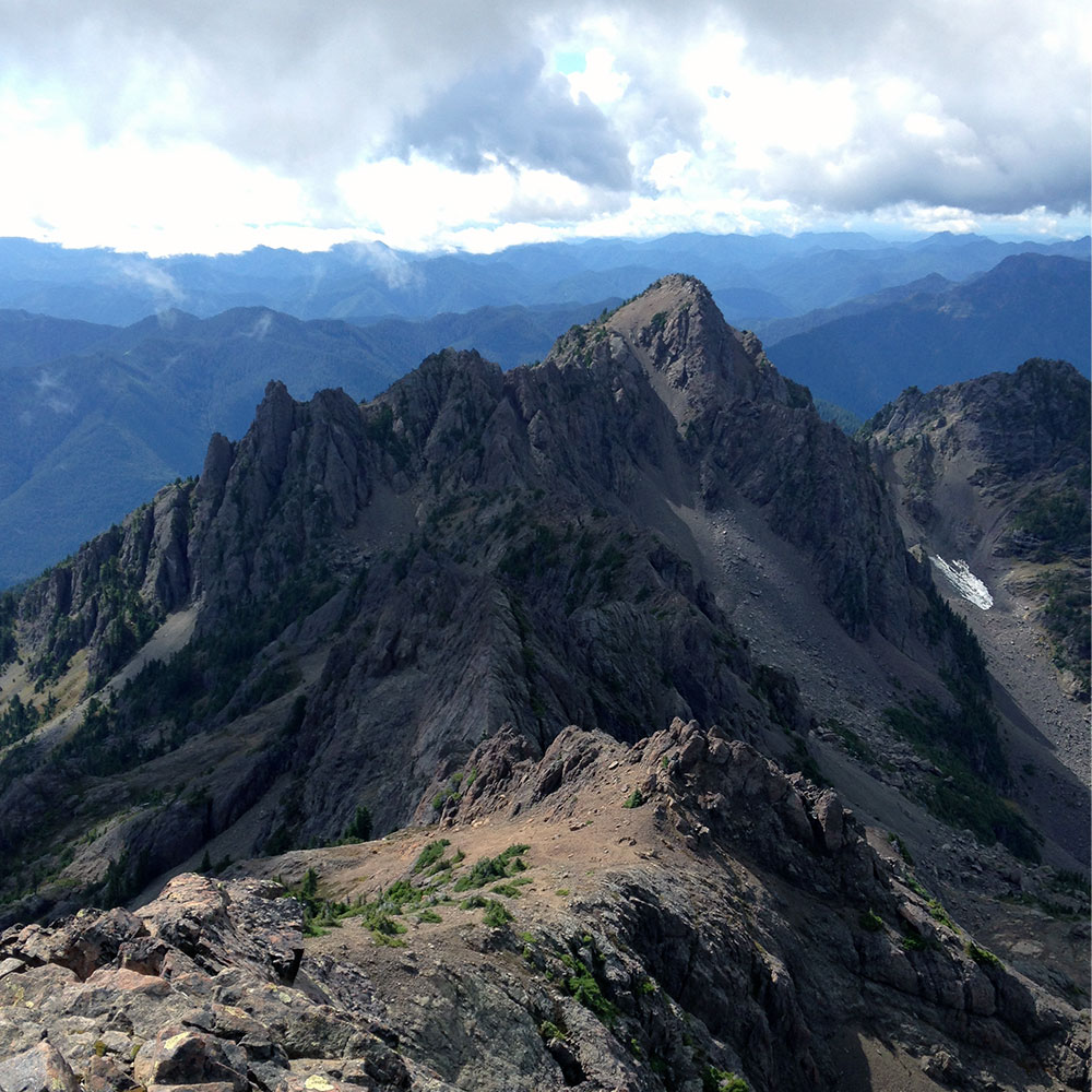
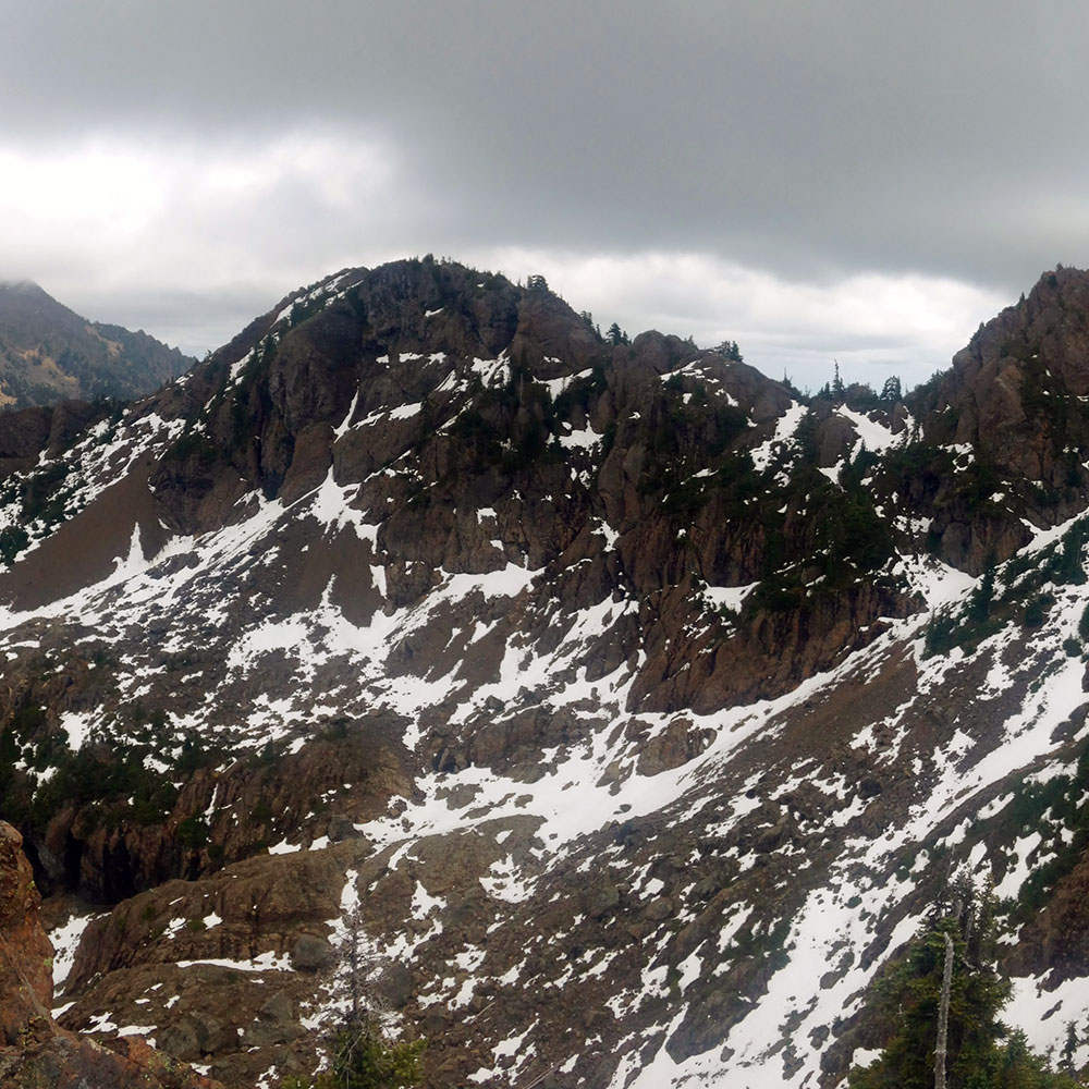
Now you'll need your navigation skills. There are a few flags posted but essentially you'll be off trail, heading up a hillside in the forest trying to find the access point to climb Copper Peak. Once above tree line the route becomes a bit clearer as you're heading over grassy rocks to the most eastern side of the mountain. The climbing route is quite exposed in the upper section and while you will feel accomplished reaching the top, this is not the highest point of Copper Mountain.
0.1miles, 200ft of vertical gain.
Drop down on the southern side of the mountain and traverse below the ridge line along a path that feels suitable to you to reach the actual high point of Copper Mountain.
1.2 miles 1,400ft of vertical loss.
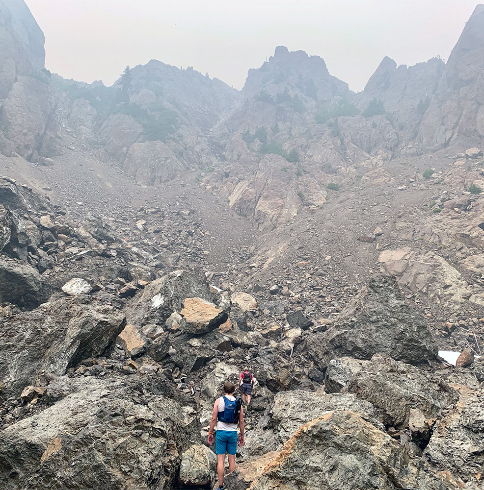
This route is off trail and leads you over boulder fields that are quite fun but will make travel slow. Stay above tree line until you're almost cliffed out and then drop through the thick underbrush, avalanche alder, and trees until you reach the lake.
0.6miles 700ft of vertical gain.
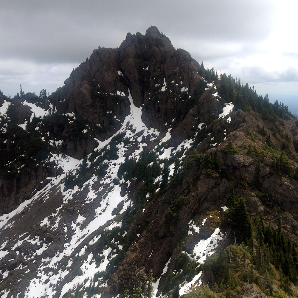
The trail to Cub Peak is a narrow boot path crossing the stream below the lake and winding its way to the left of the lake heading straight up the hill. You pop out of the trees to a grassy knoll with a boulder block at the far end. Beyond that boulder lies a short ridge line scramble to the true summit.
3.1 miles, 3,800ft of vertical loss.
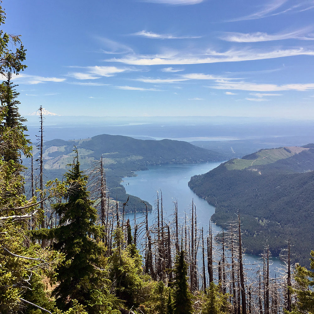
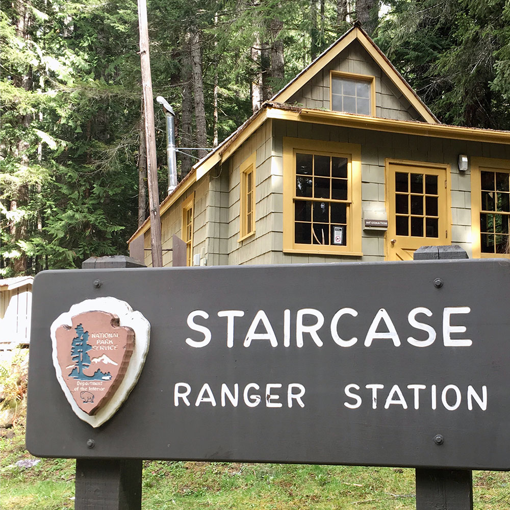
Head back down to the lake and from there take the steep and well-maintained downhill trail to the Staircase parking area and ranger station.
The campground across the road has a bathroom and running, clean water!
7miles, 400ft of vertical gain.
To make this run a full loop and avoid having to park cars at the start and end of your trek you can run the road back to Big Creek. It's not great, but makes it logistically efficient.
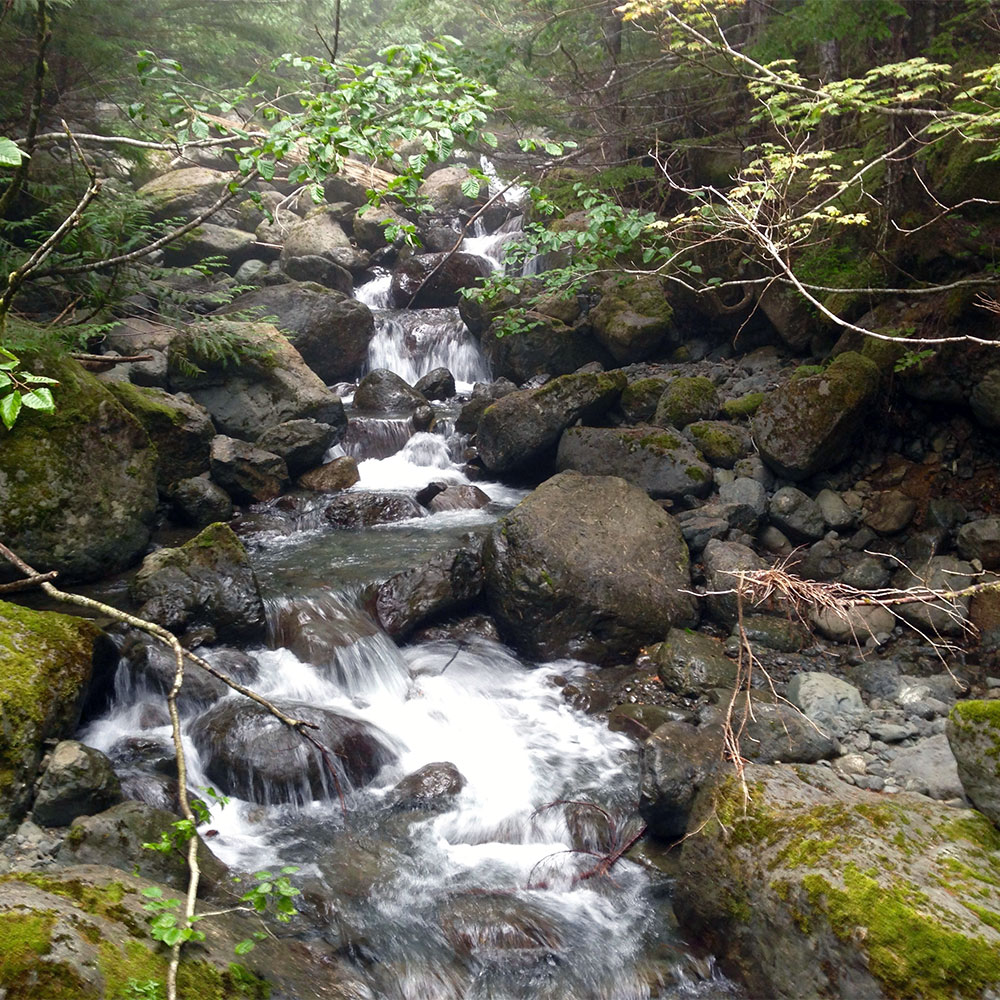
There's very little water to refuel along the route. We had stashed some, but still (almost) ran out. Wagonwheel Lake is a nasty pond and while you could filter there, it's not ideal. The couple streams we cross were reduced to tiny trickles that late in the season. Plan accordingly if you attempt the full route.
We started early and finished way later than anticipated. Beginning and ending a route with headlamps is cool. But be aware of this and plan accordingly. Charge batteries and bring backup headlamps.
Check your speed of travel. This route feels super accessible being so close to town, and it offers several spots where you can easily bail and cut the route short if needed. But once you head back up past Bear Camp toward Copper you're committed for a long push beyond cell service and in remote territory that makes travel slow.
Bring your Ten Essentials, Satellite Emergency Beacon, GPS tracking device, and backup clothing. This is a big mountain route, even if it includes Mt. Rose.
There is little running and a whole lot of mountain terrain to cover. Be ready for plenty of exposure, rough terrain that cuts your hands and legs. Scree, loose footing, and thick forested hillsides will make route finding slow and challenging. But, oh how glorious it is to stand on six mountain summits in one run.
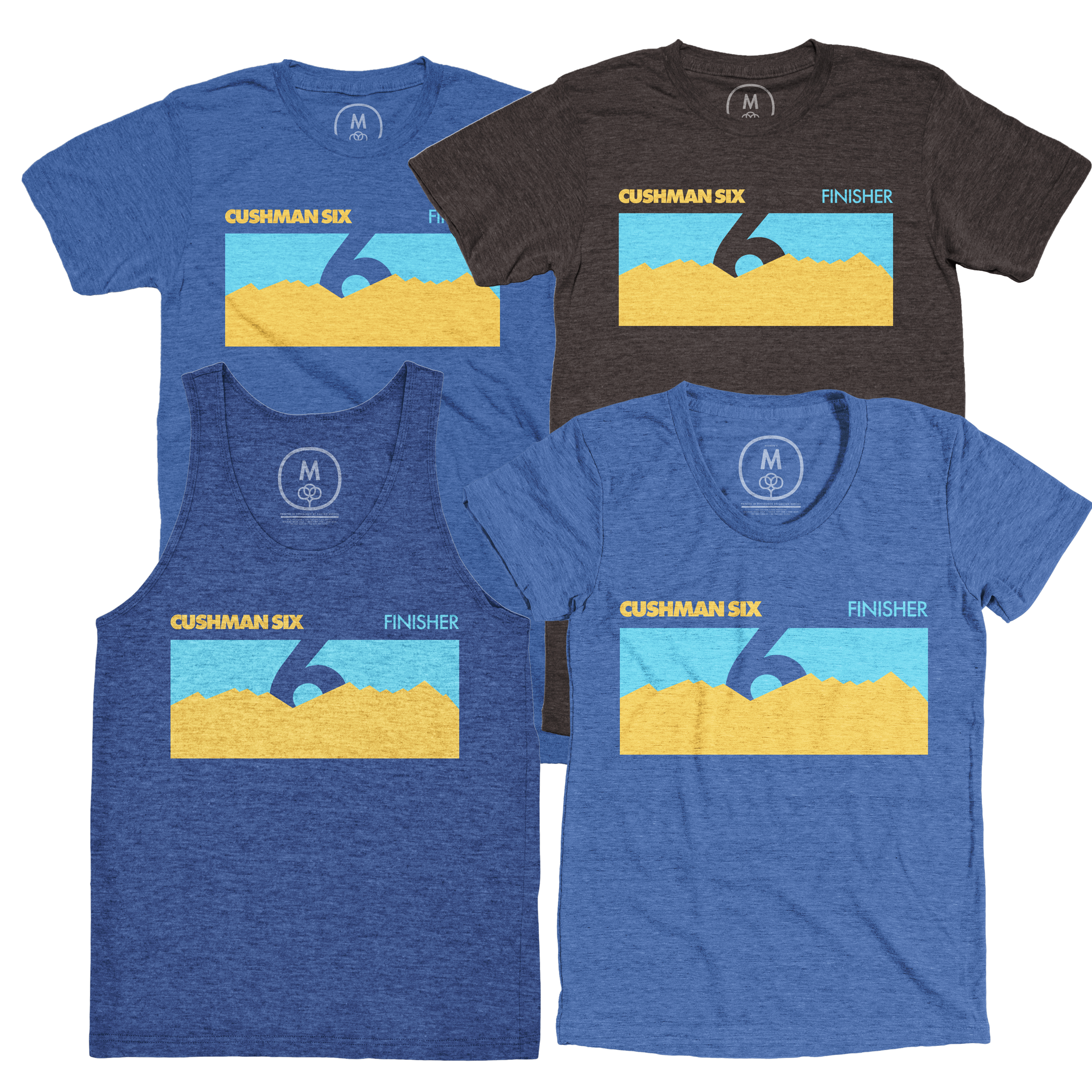
If you go: Share your run with me. I'd love to hear your stories and compare trail beta. I'll keep a leaderboard of folks who completed the route right here on the website.
About me: I'm Mathias Eichler and I dreamed up, climbed, and ran (somewhat) this route on September 12th, 2020 with my good friends Chris Strode and Scott Michie. I believe it's the first time anyone has linked these six summits in one effort.
Find more of my running adventures here. Listen to my podcast Singletrack and come running with us at Rock Candy Running.
